The Most Widely Used Boating App! A favorite among cruisers, sailors, fishermen and divers who want the same detailed charts found on GPS plotters. Go to Menu>Charts and select your region for a ONE WEEK FREE TRIAL. At the end of the free trial, you can choose to continue using the permanent features or elect to purchase a one year subscription to the overwhelming value of Navionics+ (see below). If you have a tablet, please search our HD app.
NAVIONICS+ overwhelming value subscription package:
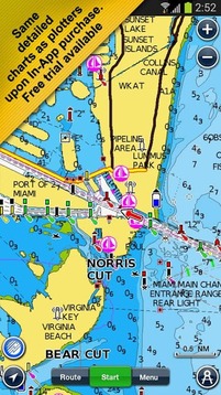
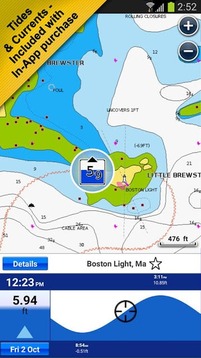
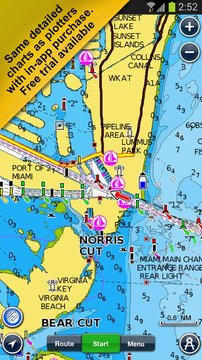
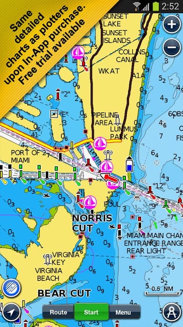
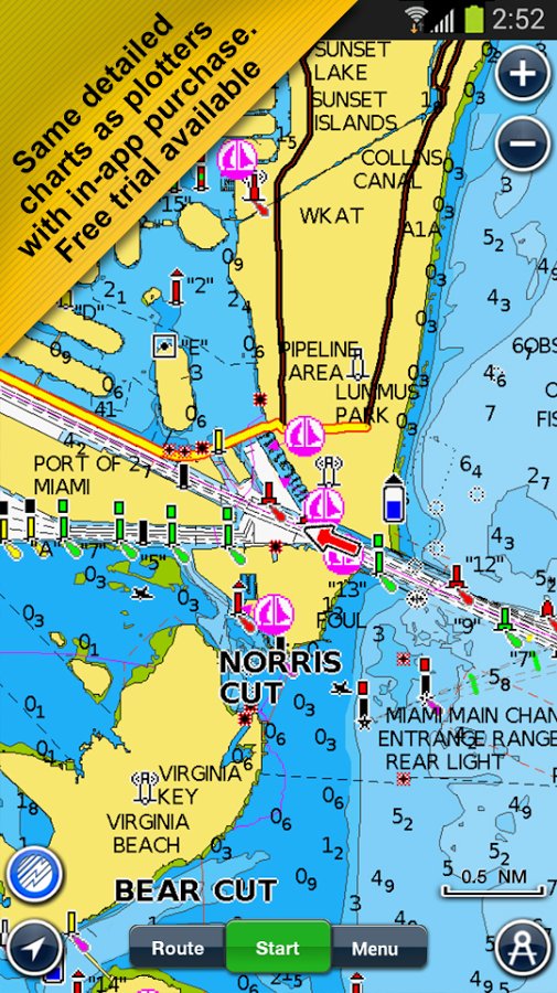
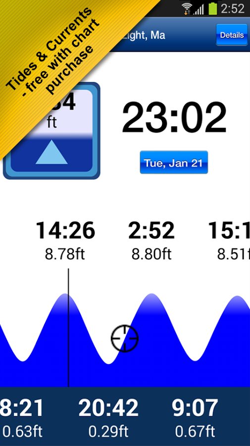
√ NAUTICAL CHART for all essential cartographic reference detail. Also get access to searchable Points of Interest like Marinas, Repair Shops and Tide & Current forecasts including dynamic graphs.
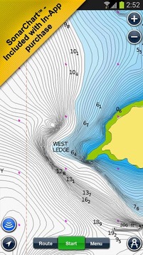
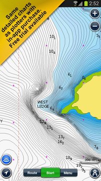
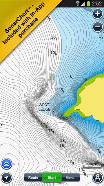
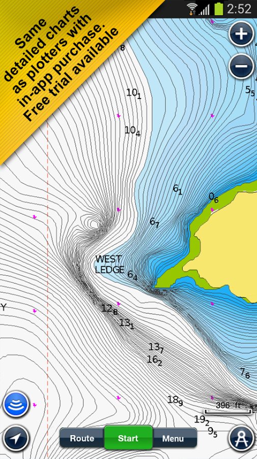
√ SONARCHART™ HD bathymetry maps you can enhance, featuring extraordinary bottom contour detail, great for increasing awareness of shallow waters and locating fishing areas at any depth level
√ COMMUNITY EDITS made by users (rocks, wrecks, etc.) and shared for all to benefit
√ CHART UPDATES: we deliver more than 2,000 updates every day! Take advantage of our updates as frequently as you like.
√ ADVANCED MAP OPTIONS to highlight Shallow Areas, select Depth Shading, filter Depth Contours, and adjust shorelines to selected Water Level. Includes a Fishing Mode
√ NAVIGATION MODULE for advanced route planning with ETA, distance to arrival, heading to WP, fuel consumption and more!
Note: Download detailed maps by zooming in or from Menu>Download Map. Maps are saved on your device for offline use. Tap Menu>Update All to keep your charts updated. Check navionics.com for coverage
At the end of one year you can choose to renew your subscription at deeply discounted prices or continue to use the charts you previously downloaded along with the permanent features of the app (see below)
Permanent FEATURES of this app:
TRACK your journey, view speed, distance, time and COG. Save to archive, see stats and playback
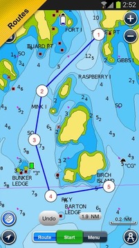
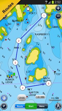
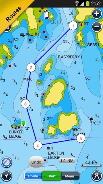
ROUTES: create and edit, based on speed and fuel consumption
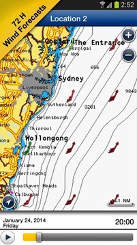
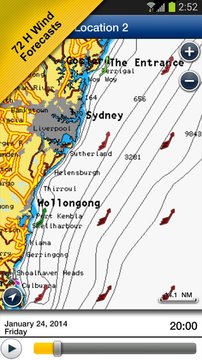
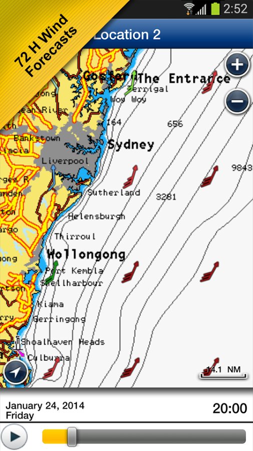
Measure DISTANCE, add MARKERS, get WIND FORECASTS and sun/moon cycles
MAP OPTIONS: Satellite/Terrain, Safety Depth and Easy View (not on Govt. Chart)
SYNC Tracks, Routes & Markers among your mobile devices
MAGAZINES & GUIDES for location-based articles from leading industry publishers
GOVT. CHART in US
SONARCHART ™ LIVE - connect wirelessly to a sounder to create your HD bathymetry map in real-time. Select devices also allow for a fishfinder in split-screen.
PLOTTER SYNC - Raymarine Wi-Fi enabled plotter owners can transfer routes and markers, upload sonar logs for improved SonarChart™ and update their eligible plotter card connecting to Navionics through this mobile app
Navionics has certified several Android models where the app is designed to load and operate correctly with an OS of 4.0 or higher. Please refer to our Compatibility Guide, which is continuously updated at http://www.navionics.com/en/compatibility/mobile . We cannot guarantee flawless operation or provide support for non-certified devices. ALL SALES ARE FINAL on Google Play.
使用最广泛的划船应用程序!当中谁想要在GPS绘图仪发现了同样详细的图表巡洋舰,水手,渔民和潜水者的最爱。进入菜单>图表,并选择为期一周的免费试用你的区域。在免费试用期结束时,您可以选择继续使用的永久性特征,或选择购买一年的订阅NAVIONICS +(见下文)的压倒性价值。如果你有一个平板电脑,请搜索我们的高清应用。
NAVIONICS +铺天盖地值订阅包:
√海图所有必需的制图参考的细节。还可以访问搜索点数像码头,维修店潮与目前的预测,包括动态图形利息。
√SONARCHART™HD地形地图可以提升,具有非凡的底部轮廓细节,极大提高浅水海域的认识和定位渔区在任何深度级别
√用户(岩石,沉船等)制成,共享给大家造福社区编辑
√海图更新:我们每天运送2000多名更新!趁我们的更新,只要你喜欢频繁。
√高级地图选项突出浅海区,选择深度着色,过滤水深线,并调整海岸线选定的水位。包括捕鱼模式
√导航模块为高级路线规划与ETA,距离到到来,前往WP,油耗和更多!
注:通过放大或菜单>下载地图下载详细的地图。地图是保存在设备供离线使用上。点击菜单>全部更新,让您的图表更新。检查navionics.com投保
在一年结束时,您可以选择续订在深深的优惠价格或继续使用先前随着应用程序的功能永久下载的图表(见下图)
这个程序永恒的特征:
跟踪您的旅途,浏览速度,距离,时间和COG。保存到归档,查看统计和回放
途径:创建和编辑,根据速度和油耗
测量距离,添加标记,获得风的预报和太阳/月亮周期
地图选项:卫星/地形,安全深度和易观(而不是在官立图)。
同步跟踪,其中移动设备的路由和标记
杂志和指南,从行业领先的出版商基于位置的文章
GOVT。图表中美国
SONARCHART™LIVE - 无线连接到发声器来创建你的高清地形图实时。选择设备还允许在分屏一探鱼。
绘图仪同步 - 的Raymarine的Wi-Fi功能的绘图仪的业主可以转移路线和标记,通过这个移动应用程序上载声纳日志改进SonarChart™和更新他们的资格绘图卡连接到NAVIONICS
NAVIONICS已经认证了几款Android机型,其中应用程序设计成可以装载和使用的4.0或更高版本的操作系统的正常运行。请参阅兼容性指南,它是在不断更新的http://www.navionics.com/en/compatibility/mobile。我们无法保证其正常工作或者提供未经认证的设备的支持。所有销售是最终在谷歌播放。
最畅销的划船更新内容
· Bug fixing and optimization
. Detailed coverage of Hong Kong is temporarily removed.


网友评论更多