
Powerful, both GPS and Google Map. Shows satellite pics real time as you move!
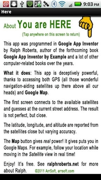
This app was programmed in Google App Inventor by Ralph Roberts, author of the forthcoming book Google App Inventor by Example and a lot of other computer-related books over the years.
What it does: This app is deceptively powerful, thanks to accessing both GPS (all those wonderful navigation-aiding satellites up there above all our heads) and Google Map.
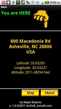
The first screen connects to the available satellites and guesses at the current street address. The result is not perfect, but close.
The latitude, longitude, and altitude are reported from the satellites close but varying accuracy.
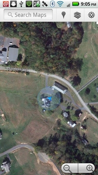
The Map button gives real power! It gives puts you in Google Maps. For example, follow your location while moving in the Satellite view in real time!
Enjoy! It’s free. See ralphroberts.net for more about Ralph.
©2011 ArrSoft, arrsoft.com
此版本中的新功能:
first release
HERE


扫一扫安装
豌豆荚发现更多
手机扫码安装豌豆荚


网友评论更多