A free taster app of the select guidebook for rock climbing in North Wales authored by Mark Reeves and published on theSend.co.uk topo apps platform.
This lite version of the full North Wales Rock Climbing Topo App contains full coverage of one crag, Vivian Quarry on the Slate providing all the functionality of the full guide which is described below.
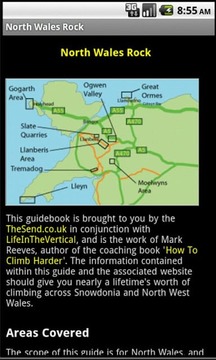
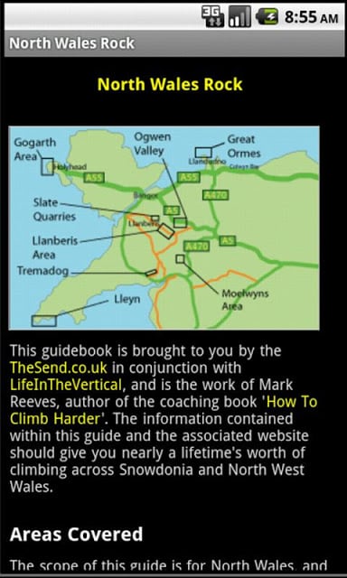
The full guide covers selected classic rock routes of the North Wales area from the sea cliffs of Gogarth to the mountains of Snowdonia. The areas covered in the first edition are:
- Anglesey: Gogarth, Rhoscolyn, Benllech
- Llanberis Pass
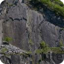
- Slate
- Ogwen Valley
- Tremadog
- Moelwyns
- North Wales Limestone
At present the full guide contains almost 750 routes across 156 topos covering 7 major climbing areas in North Wales You can review the areas and crags covered on the supporting website at http://theSend.co.uk/NorthWalesRock/
Application features:
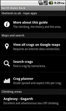
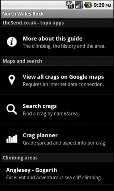
- a general introduction to the climbing in this area.
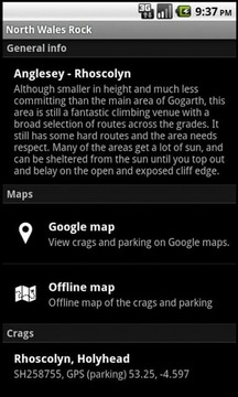
- crag search and maps for the whole guide, area by area and crag level.
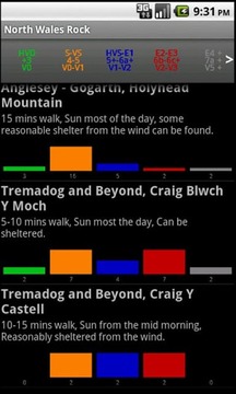
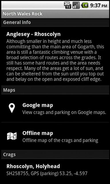
- detailed crag info including walk-in, sun/shade conditions, parking, access and approach information.
- detailed sector information.
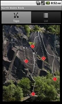
- interactive sector by sector topos showing both the sport and traditional climbing
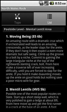
- up to date routes and problems lists with full descriptions
- route info selection from the routes listing and route badges on the topos.
- area by area sketch maps for most of the crags for for full offline use
- split parking and crag map pins when the map is zoomed in, with directions from your current location available from the parking pin.
Please note that in order to keep the download file size small, the app isn't preloaded with any of the topo images. You will be prompted to download these when the app runs and we recommend a wi-fi connection for this.
一个免费的品酒师在北威尔士的应用程序的选择指南岩石攀登撰写的马克·里维斯和theSend.co.uk地形应用平台上发布。
此精简版的全北威尔士的攀岩地形应用程序包含了完整的覆盖面岩,邬君梅鲗鱼在石板上提供的所有功能的完整指南,说明如下。
完整的指南涵盖了从海崖的Gogarth的雪墩山北威尔士地区的经典摇滚路线的选择。在第一版中所涉及的领域有:
- 安格尔西:Gogarth,Rhoscolyn,Benllech
- 兰贝里斯通行证
- 石板
- Ogwen谷
- Tremadog
- Moelwyns
- 北威尔士的石灰石
在目前的指南包含近750的路线横跨156 TOPOS,覆盖7个主要的攀登,您可以查看在北威尔士地区覆盖的领域和峭壁上的支持网站http://theSend.co.uk/NorthWalesRock/
应用特点:
- 在这方面的攀登。
- 岩,搜索和地图为全导,区,岩石区的水平。
- 详细的峭壁信息,包括步行路程,阳光/阴天条件下,停车场,访问和方法的信息。
- 详细的部门信息。
- 同时显示运动和传统攀岩由部门TOPOS的互动部门
- 日路线和问题清单的完整描述
- 路由信息选择的路线清单和路线的TOPOS徽章。
- 完整的离线使用面积的区域多量的峭壁
- 斯普利特停车场时,岩石地图上的大头针在地图被放大时,从您目前的位置可从停车场针的指示。
请注意,以保证下载文件的大小小,应用程序是不预装任何地形图像。系统将提示您下载这些应用程序运行时,我们建议的Wi-Fi连接。
北威尔士攀岩精简版更新内容
BUG修复。


网友评论更多