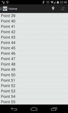
Droid 2 CAD lets you to capture points or locations using your android handset's GPS then export them to file for later use.
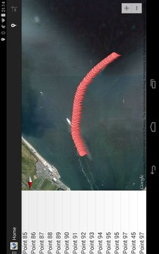
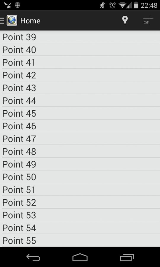
Points can be auto numbered or named when captured these are included in the export along with the geographic co-ordinates for easy identification later on.
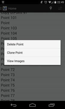
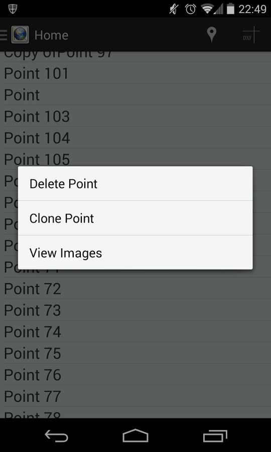
Individual points can be copied or deleted by long pressing on the point entry in main point list.
Capture photos though the application and they will be associated with a point.
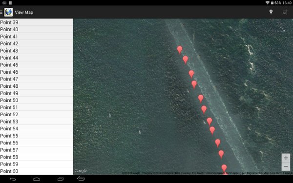
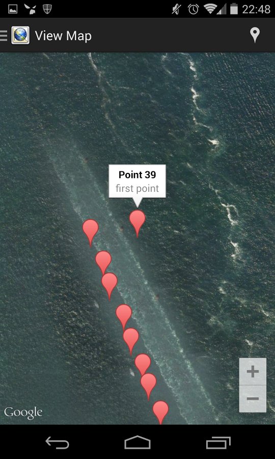
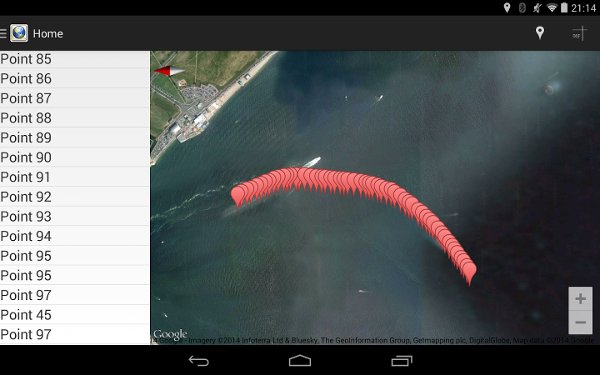
An Integrated Google maps view allows you to check how accurate your captured points are and adjust using drag and drop functionality to improve accuracy before exporting.
Points can be exported in the following formats:
DXF – readable in many CAD packages including Autodesk’s AutoCAD. Points are plotted relative to the first point captured which is used as the origin (0,0,0).
KML- Point data can be imported into Google Earth.
CSV – View and manipulate your data in Google Docs, MS Excel and many others
Open a DXF file directly in AutoCAD WS (if installed)
Import points from a CSV file. Format should match the format exported by Droid 2 CAD.
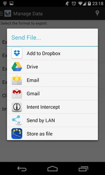
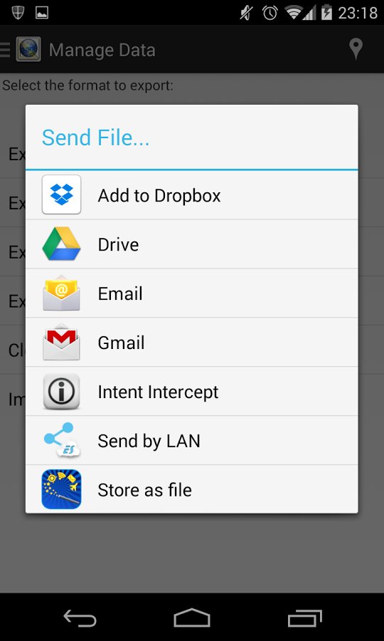
Once exported files can be sent to a number of other applications including attached to emails or saved to Dropbox, Google Drive or Microsoft SkyDrive (if installed).
Droid 2 CAD provides basic support for honeycomb and later Android tablets.
This application is supported by ads and use Flurry analytics.
If you find this application useful please leave feedback.
Find QubeCAD on twitter @qubecad , G+ or facebook
If you have any problems please email me quoting make and model of device, Android version, and a description of the problem. An example of some gps data would also be useful.
Note:
Point accuracy is restricted by the accuracy of the Android handset, the number of satellites available and can be degraded in built up areas. This application should not be used for any critical projects, and is provided without any guarantee.
If you have an issue or would like a feature adding you can raise it at:
https://bitbucket.org/chughes42/droid2cad-public/issues
Try out the forth coming new version!
Join the beta test at https://play.google.com/apps/testing/qubecad.droidtocad
Droid 2的加元让你使用你的android手机的全球定位系统,然后将它们导出到文件供以后使用捕捉点或位置。
积分可自动编号或被俘时命名这些都包含在随地理坐标出口,便于识别以后。
个人积分可以长按在主点列表的入口点被复制或删除。
拍摄照片虽然应用程序,他们将与点相关联。
集成谷歌地图视图允许你检查你的捕获点,如何准确并调整使用拖放功能在出口之前提高准确性。
积分可以导出下列格式:
DXF - 可读在许多CAD软件包包括Autodesk公司的AutoCAD。点被绘制相对于所捕获的第一点,用于为原点(0,0,0)。
KML点的数据可以导入到谷歌地球。
CSV - 查看和操纵谷歌文档,MS Excel和许多其他数据
直接在AutoCAD WS中打开一个DXF文件(如果已安装)
导入点从CSV文件。格式应该与Droid 2的CAD导出的格式。
一旦导出的文件可以发送到其他一些应用,包括连接到电子邮件或保存到Dropbox,谷歌驱动器或Microsoft SkyDrive中(如果已安装)。
Droid 2的CAD能够蜂窝,后来Android平板电脑的基本支持。
此应用程序是通过广告和使用乱舞分析支持。
如果您发现该应用程序非常有用请留下反馈。
查找QubeCAD在twitter上@ qubecad,G+或Facebook
如果您有任何问题,请给我发电子邮件引述制作和设备,Android版本,和问题的描述模型。一些GPS数据的例子也将是有用的。
注意:
点的精度是由Android手机,卫星的可用数目的精度受到限制,并且可以在建成区退化。此应用程序不应该被用于任何重要的项目,且无任何保证提供。
如果你有问题或想一个功能加入,您可以在提高它:
https://bitbucket.org/chughes42/droid2cad-public/issues
尝试提出未来的新版本!
参加beta测试的https://play.google.com/apps/testing/qubecad.droidtocad
Droid 2 CAD更新内容
新版变化
V4.03 reinstated missing counter functionality.
Renamed view Photos to Documents.
V4.01
Fix for crash when taking a photo before capturing a point.
Photos can now be opened from within the application.
Share menu entry added to allow adding documents from 'Send Link' in Google Drive.
Fixed working with DXF Camera
了解更多


网友评论更多